21 ROLFES LN
Owner Information
BELT STEVEN & ADRIENNE
21 ROLFES LANE
NEWBURY, MA 01951


Property Details
21 ROLFES LN is classified as a Single Family Residential (Antique).
The primary structure on this property was built in 1775. There are 4,632ft2 of built area within this property. There is 4,632ft2 of residential/living space within this property. This property is listed as having 11 rooms.
21 ROLFES LN is valued at $1,224,400. The land is valued at $376,500 and the structures are valued at $832,100. There is an additional valuation of $15,800 on this property.
The most recent deed for 21 ROLFES LN is recorded at the local registrar in Book 38645, Page 244. 21 ROLFES LN was last sold on Friday, June 19, 2020 for $1.
Assessment data from fiscal year 2022.
Flood Data
According to the FEMA National Flood Hazard Layer, this property does not appear to be in a flood zone. It may also be in an area not yet reviewed. Nonetheless, confirm this information prior to taking any action.
To view the flood hazards around this property, create a FEMA "Firmette" Map of the area around 21 ROLFES LN.
Broadband Internet Providers
| Provider | Type | Bandwidth (mbps) | |
|---|---|---|---|
| HughesNet | Satellite | 25 | 3 |
| Comcast | Cable | 1000 | 35 |
| Verizon New England Inc. | DSL | 7 | 0 |
| Viasat Inc | Satellite | 100 | 3 |
| VSAT Systems, LLC. | Satellite | 2 | 1 |
| GCI Communication Corp. | Satellite | 0 | 0 |
Broadband service provider data from December 2020.
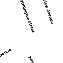
Adjacent Properties
- 4 WITHINGTON ST
Single Family Residential owned by POPP BRYON C - 15 ROLFES LN
Single Family Residential owned by PEET BETSEY J - 0 ROLFES LN
Undevelopable Residential Land owned by BELT STEVEN - 2 FAIRVIEW AV
Single Family Residential owned by LADD TE PEARL H - 6 WITHINGTON ST
Single Family Residential owned by IRVING ARTHUR P - 0 FAIRVIEW AV
Single Family Residential owned by FOLEY TE TIMOTHY F - 4 R FAIRVIEW AV
Single Family Residential owned by RONDER RICHARD W